
Consultation before applying for planning permission
Why is the project needed?
The Barmouth North Promenade forms part of the coastal defence for the town of Barmouth. It protects the properties directly behind the promenade, the railway line and the coastline more generally. The promenade and Marine Parade are currently built up on a raised embankment and form part of the overall defence to the sea. The front of this embankment is a sea wall (sheet piles, masonry faced slope and a curved wall primary wall).
The Promenade has been a feature of Barmouth for over a century, with the defence being added to and enhanced over the decades. Construction of the concrete structure and groynes in the 1930s led to declining beach levels, prompting sheet piling works in 1955 to reinforce the wall, with further work needed in 1972 where the foundation of the promenade structure was strengthened due to lowering beach levels.
From the early 2000s beach levels have decreased more rapidly with sea level rise. The predominant wave direction at Barmouth is perpendicular to the shoreline, which makes transport up and down the beach of sediment predominant over longshore movement. The dunes to the South have grown substantially since construction of the causeway in the 1970s which led to an initial accumulation of sediment on the northern part of the structure.
Following that initial sediment deposition, wind-blown transport has continued to contribute material to the dunes which has led to their current size. Without the scheme, beach levels will continue to drop as the waves reflect on the vertical wall of the concrete structure and erode the seabed. The rock revetment will absorb energy from the waves reducing the rate of erosion and limiting the lowering of beach levels.
Due to its age, the condition of the promenade is deteriorating, which increases the risk of a storm events breaching the defence, as experienced in 2021 when part of the north end of the promenade failed.
Climate change is causing sea levels to increase resulting in higher water levels. It also increases the frequency and intensity of storm evnts and rainfall events. The combination of these factors means bigger, more frequent storm surges, which increase the risk of flooding to Barmouth.
There was a major flood event in 2014 when the North Promenade defence was overwhelmed and flooding occurred behind the Promenade. With no improvements to the North Promenade defence over 900 properties are at risk of flooding with current day conditions (1% chance in any given year).
What is the solution?
The Barmouth North Promenade Flood Alleviation Scheme has been designed to protect Barmouth from current and future flood risk from the sea. The defence is formed of several parts, which use the existing promenade sea defence and would work together to prevent flooding to property and land:
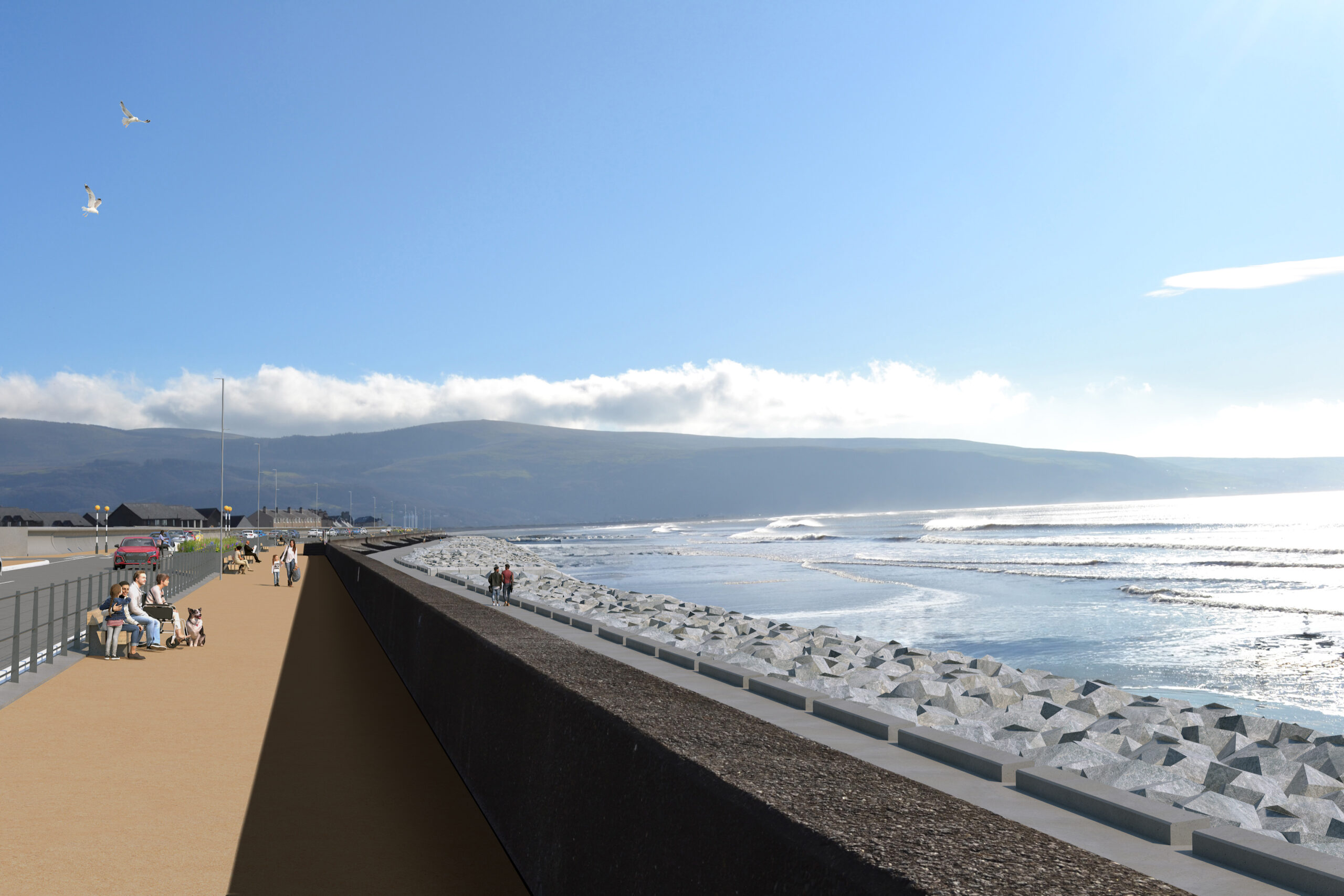
- Rock Armour (large rock blocks) would be placed in front of the existing sea wall on the beach to help break waves and absorb the energy. This would reduce the amount of water that would overtop the existing recurve wall (Primary Wall);
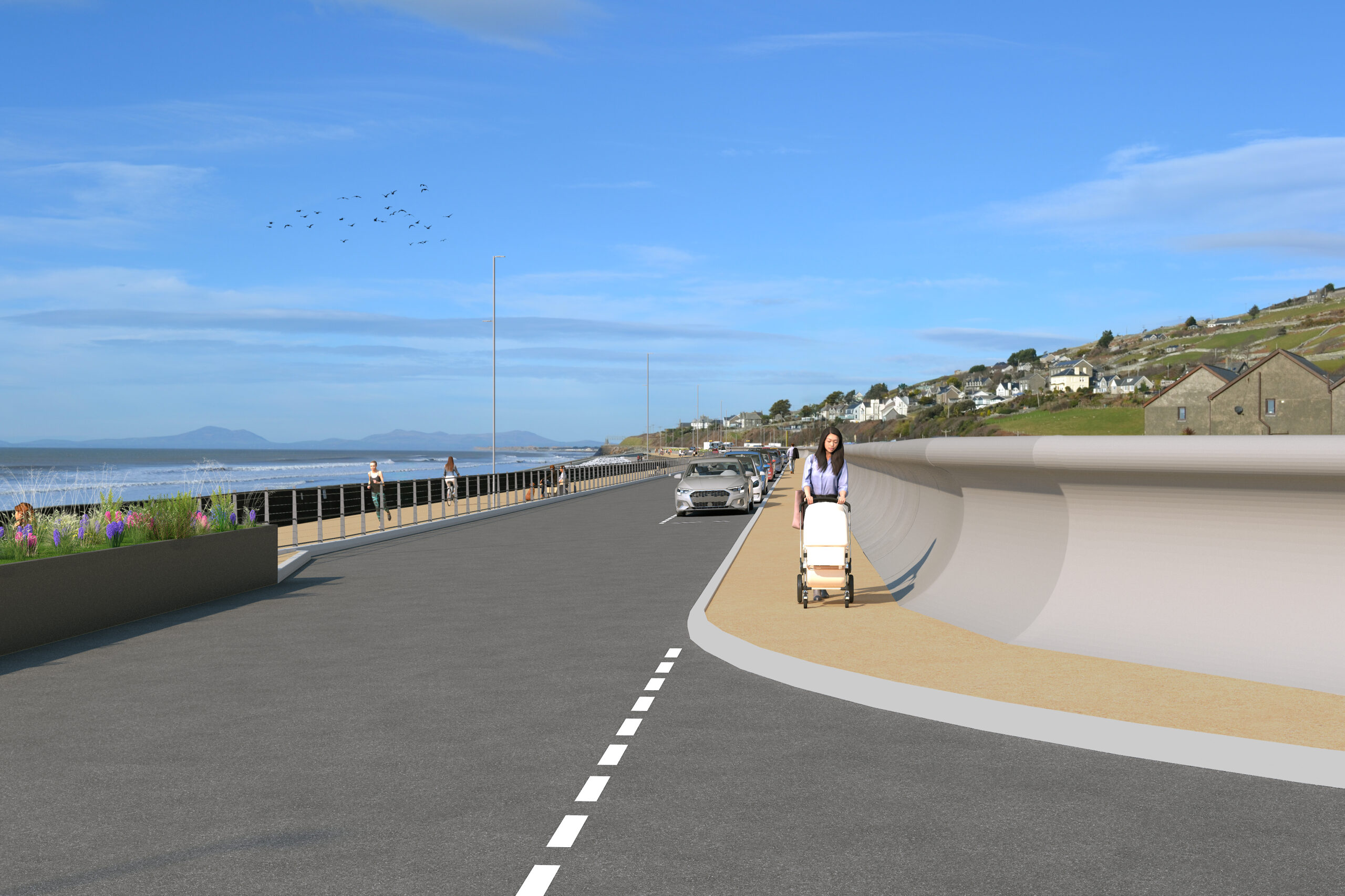
- A new back wall (Secondary Wall) would be built at the back of the Marine Parade Road, generally along the line of the existing masonry wall. This wall would stop any water and waves that do overtop the Primary Wall from getting to the land and properties beyond the promenade; and
- Flood gates at road junctions and openings along the Secondary Wall, which would be closed in a flood event to prevent sea water from passing through.
The whole promenade and road would form part of the sea defence, with the promenade and road flooding occasionally – our modelling shows this might happen up to once a year initially, occurring more regularly over time due to climate change. During a flood event that will likely result in water along the Marine Parade Road, the promenade and road would be closed to the public, with gates closed to discourage access. Water will drain from the promenade through the existing sea defence drainage and from the slipways to the North and South of the scheme.
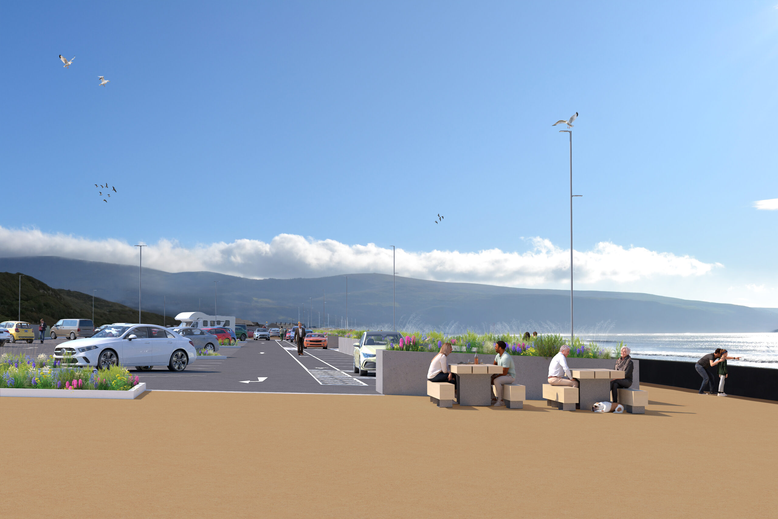
Through the development of the solution we have considered how we can make the promenade as attractive and functional for the public as possible. The solution includes the following key features:
- Six sets of steps from the promenade onto the beach at regular intervals;
- An improved northern slipway to aid accessibility for all users;
- Improved accessibility across the Marine Parade Road for all users, and to access Hoel-y-Llan, Heol-y-Plas, Hoel Idris and Princes Avenue;
- Improved parking at the North Promenade Car Park and along Marine Parade;
- Landscaping, improved lighting and planting to create an attractive and pleasant environment for everyone; and
- Enhanced cycling facilities (promenade surface and bike lock facilities).
How have we decided on this solution?
A significant amount of work and development has been undertaken over the last year to understand the problem and to shape the solution. We have worked closely with our Contractor and Designer to carefully consider the functionality of the defence, the cost of the proposals and how people would use the promenade.
Extensive modelling, both digital and physical, has been undertaken to help determine the key parameters of the defence:
- The digital modelling uses industry standard computer models and practices to determine the impact of different flood events, whilst considering the impact of rainfall for a variety of different scenarios.
- The physical modelling involved building a scale model of the sea defence in a water flume and testing different storm events to understand how the sea defence performs. Amendments were made to the model to optimise the defence.
This modelling has helped define: the total length of the defence and how far south towards Barmouth it needs to extend; how high the Secondary Wall needs to be; the size/placement of Rock Armour; and the need for flood gates.
We have undertaken extensive stakeholder engagement with interest parties (both statutory and non-statutory) including Natural Resources Wales, Natural England, emergency services (including coastguard), Cyngor Gwynedd, community and town councils and the public.
We have undertaken environmental surveys to understand the species and habitats present and undertaken a full Environmental Impact Assessment. The Pre-planning Application Consultation (PAC) includes the full suite of information that has been prepared following the full consideration of the proposal.
What other options did we consider?
Through the development of the project, several alternative options were considered for enhancing the coastal sea defence. The following options were considered, but discounted (list not exhaustive):
- Do nothing – this was considered as a baseline to compare with the other options
- Beach reprofiling and recharge – instead of Rock Armour, the beach level was considered to be increased to improve protection, with heavier material like cobbles. This was discounted on the basis of defence performance, cost and environmental and amenity impact.
- Managed realignment – This involves defences being brought landward and naturalising the coastline. However, this would likely lead to loss of land, property or infrastructure and so was not considered further.
- Offshore defence – an offshore reef or breakwater was considered. This would require very large amounts of material being deposited on the beach relatively close to the promenade in order to be effective, severely impacting on views and the beach’s amenity value as well as presenting safety and navigational risks (by creating a new offshore structure close to the shore) and significant impacts on the sensitive offshore habitats. It is also anticipated to be very high cost.
- Groynes – the existing performance of the groynes was carefully considered. From a review of the local coastal processes including historical information, it was determined that there is very little movement of material along the beach (longshore drift) in the location of the promenade. Generally, lowering of the beach has been due to wave reflection from the existing concrete promenade. Therefore, the cost of refurbishing the groynes outweighed the benefit they provide.
- Increasing the Primary Wall height (the main sea wall), which would result in needing to significantly raise the height of the promenade embankment and wall. Given the age and nature of the existing structure, this would likely require significant reconstruction of the entire wall.
Conclusion
The proposed solution is considered to provide the best balance of flood defence, affordability, environmental impact and public amenity.
Images depicting the proposed solutions are provided below.
Images depicting the proposed solutions

March public exhibition
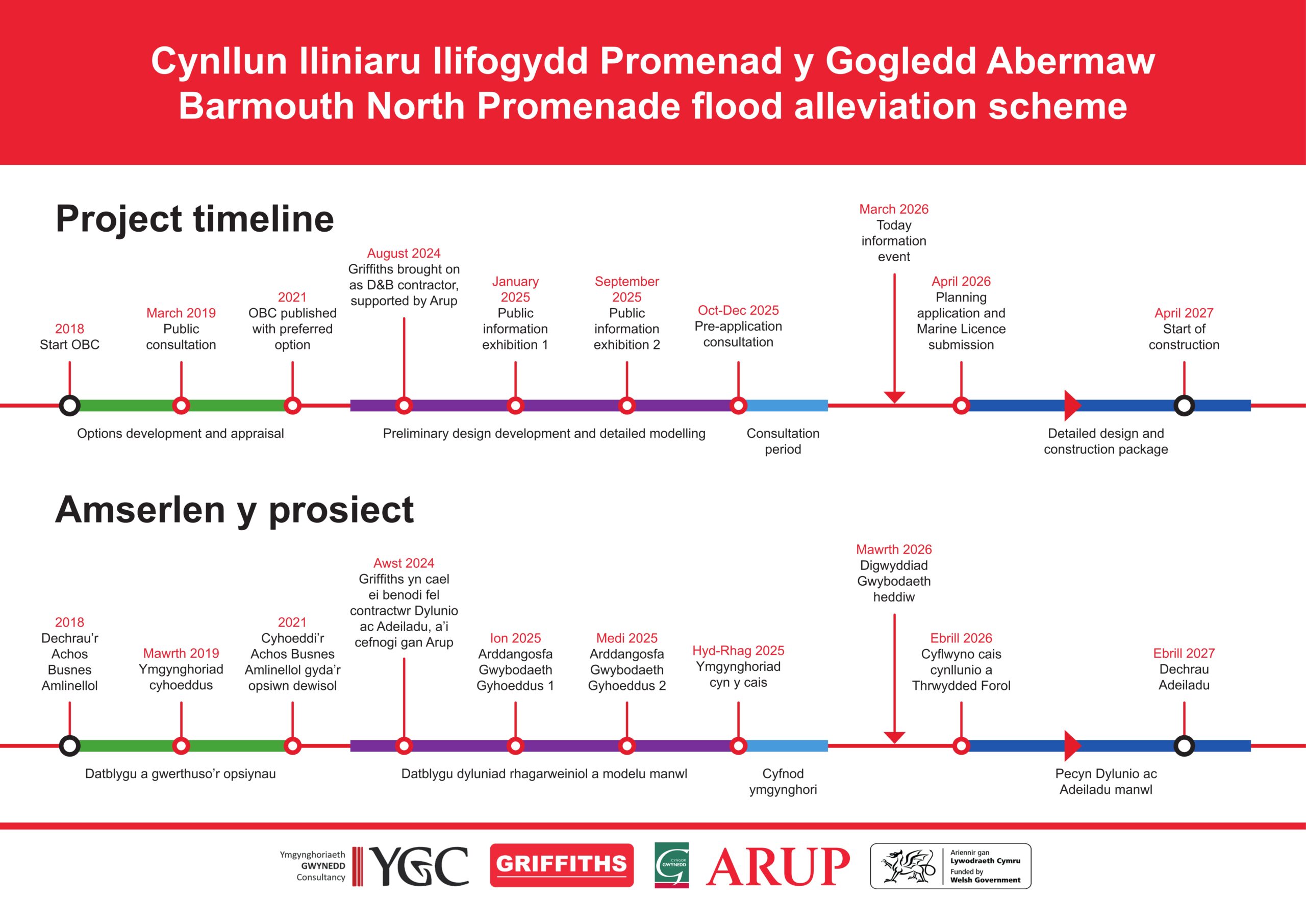


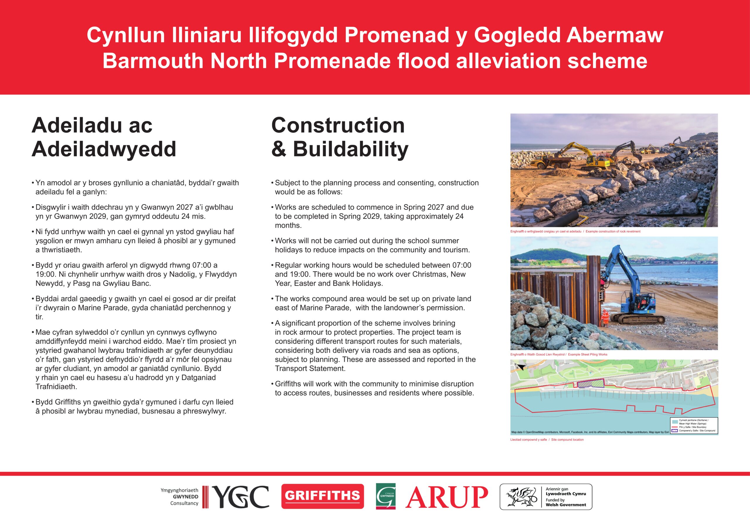
Anyone who wishes to make representations about this proposed development must write to the Applicant via email at: callabermaw@gwynedd.llyw.cymru by the 03/04/26
Or by post to:
Ymgynghoriaeth Gwynedd Consultancy,
Swyddfa Penrallt,
Caernarfon,
Gwynedd,
LL55 1BN
If you do not have specific requirements which means you require hard copies of specific documents, please call the Consultation Team on:
01286 679426.
Barmouth flood alleviation scheme
FCRMU@gwynedd.llyw.cymru
YGC | Ymgynghoriaeth Gwynedd Consultancy
Swyddfa Penrallt
Caernarfon
Gwynedd
LL55 1BN
Our Work
Info
Initiatives
Other projects

(01286) 679426

